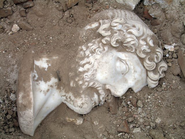
The ancient site of Aigai, one of the twelve cities of Aeolis, is located some twenty miles north-west of Manisa. The ruins are impressive, but the journey is a tough one.
It is accessible by Jeep from the coast road near Aliağa.
The area is called Nemrut Kale in Turkish and is no longer inhabited.
Aigai, also Aigaiai (Ancient Greek: Αἰγαί or Αἰγαῖαι; Latin: Aegae or Aegaeae; Turkish: Nemrutkale or Nemrut Kalesi) was an ancient Greek, later Roman (Ægæ, Aegae), city and bishopric in Aeolis. Aegae is mentioned by both Herodotus and Strabo as being a member of the Aeolian dodecapolis. It was also an important sanctuary of Apollo. Aigai had its brightest period under the Attalid dynasty, which ruled from nearby Pergamon in the 3rd and 2nd century BC.
The remains of the city are located near the modern village of Yuntdağı Köseler in Manisa Province, Turkey. The archaeological site is situated at a rather high altitude almost on top of Mount Gün (Dağı), part of the mountain chain of Yunt (Dağları).
History
The area of Aeolia was that stretching along the coast of Western Anatolia and was founded, according to legend, by the descendants af Agamemnon. Aigai was an Aeolian colony from Its origins, and according to Herodotus, wos the oldest city in Aeolia. it was here that Themistocles, being in exile, made his way secretly In a lady’s litter to the Persian court at Susa. The town can never have been a political power, owing to its unfavorable position in a remote spot in steep mountainous country. It lay on the outskirts of the other Aeolian towns.
Path to Aigai
Initially the city was a possession of the Lydian Empire and later the Achaemenid Empire when it conquered the former. In the early third century BC it became part of the Kingdom of Pergamon.
It changed hands from Pergamon to the Seleucid Empire, but was recaptured by Attalus I of Pergamon in 218 BC.
Plan of Aigai drawn by Richard Bohn in 1889
In the war between Bithynia and Pergamon, it was destroyed by Prusias II of Bithynia in 156 BC. After a peace was brokered by the Romans, the city was compensated with hundred talents. Under the rule of Pergamon a market building and a temple to Apollo were constructed.
In 129 BC the Kingdom of Pergamon became part of the Roman Empire. The architecture of the reconstruction was tit at of the style of Pergamum. In this period the town had more importance ond expanded. It was badly damaged by the great earthquake of 17 A.D. which shook the whole region, but it recovered and enjoyed prosper it’s agoin for another period.
Ægæ was important enough in the Roman province of Asia Prima to become one of the many suffragans of its capital Ephesus's Metropolitan Archbishopric; but it as to fade.
The first western visitors of Aigai were William Mitchell Ramsay and Salomon Reinach in 1880. They reported about their visit in the Journal of Hellenic Studies and the Bulletin de Correspondance Hellénique. They were followed by Richard Bohn and Carl Schuchhardt, who examined the site as a part of the excavations in Pergamon.
Since 2004 the site is being excavated by Ersin Doğer of Ege University in Izmir. By 2010 the access road, the bouleuterion, the odeon, shops, numerous water pipes and large parts of the market hall were uncovered. For the coming years it is planned to re-erect the market hall's facade with the original stones.
Monuments
The site of Aigai is similar to that of Pergamum in that it is a long rocky acropolis, stretching in four successive tiers to a point in the northeast.
Stoa
Agora
The extension towards the south of the original enclosure is built In fine regular courses, very much like the Wall of Eumenes ot Pergamum.
Macellum
Macellum
They both have the same style of decoration and seem to have been designed by the same architect. This southern section af thé walls forms an excellent defence.
The stadium stood on the lower terrace and the theoter was higher up. Its cavea was carved out of the rock and the stage was on a long platform. A small portlcoed temple occupies the upper terrace on the west, but the best-preserved building is the covered market which is also located on the upper terrace. The market building is rectangular and originally consisted of three levels.
Bouleuterion in Aigai
Temple of Apollo
Temple of Apollo photo 1880
Temple of Athena
Gymnasion
Nekropolis
Nekropolis
Byzantine Basilica
The city is situated on a plateau at the summit of the steep Gün Dağı mountain, which can be climbed from the north. The plateau is surrounded by a wall with a length of 1.5 kilometers. On the eastern side are the remains of the three-story indoor market with a height of 11 meters and a length of 82 meters. The upper floor of the Hellenistic building was renovated in Roman times.The partially overgrown remains of many other buildings are scattered over the site. These include the acropolis which is laid out in terraces, a Macellum, a gymnasium, a bouleuterion and the foundations of three temples.
About five kilometers to the east the foundations of a sanctuary of Apollo are found on the banks of the river which flows around the ruins. It was an Ionic order peripteros temple from the first century BC. A cella which is six meters high and three monoliths still remain
Militants from the Islamic State group have destroyed part of the Roman Theatre in the ancient city of Palmyra.
Syria's antiquities chief said the tetrapylon - a group of four pillared structures which were mainly modern replicas - has also been ruined.
The jihadists recaptured the Unesco-listed archaeological site in December from government troops.
The head of the UN cultural body said the destruction was "a new war crime".
Its director general, Irina Bokova, said what she described as "cultural cleansing by violent extremists" had resulted in "an immense loss for the Syrian people and for humanity".
IS destroyed other monuments after it first seized Palmyra in May 2015.
The group held the site and nearby city known locally as Tadmur for 10 months.
The militants were forced out by a Russian-backed government offensive in March 2016, but regained control while pro-government forces where focused on battling for the city of Aleppo late last year.
Maamoun Abdulkarim, the head of the Syrian government's Antiquities Department, told the Associated Press that reports of the latest destruction first trickled out of Palmyra late in December, and then satellite images which became available late on Thursday confirmed it.
The US-based American Schools of Oriental Research posted the images on its Facebook page, saying only two of the tetrapylon's columns remain, and the monument appeared to have been intentionally destroyed using explosives.
Only one of the structure's columns is original, as the others were rebuilt in 1963.
On Thursday, a monitoring group said IS militants had beheaded four people and shot eight others dead outside a museum close to the archaeological site.
The militants have previously carried out killings in the Roman Theatre.
When they first held the archaeological site, they blew up temples, burial towers and the Arch of Triumph, believing shrines and statues to be idolatrous.
They also destroyed the Temple of Bel - the great sanctuary of the Palmyrene gods - which had been one of the most important religious buildings of the 1st Century AD in the East.
Back in 1913, workers were excavating for a railroad station near Yavneh, in western Israel, when they discovered the two-foot-square white stone slab bearing 20 lines of text in Samaritan, an early Hebrew script. More than a century later, that same 200-pound slab is set to go up for auction next month. The minimum opening bid is $250,000, though experts think it will likely sell for much more. Believed to have been carved between 300 and 500 A.D. to adorn an ancient synagogue, the tablet is the earliest known stone inscription of the 10 Commandments.
According to the Old Testament, God revealed the 10 Commandments, carved on two stone slabs, to Moses on Mount Sinai. As a central part of the shared Jewish and Christian heritage, the set of divine precepts—including instructions to worship only God and honor one’s parents along with prohibitions on murder, adultery, theft, blasphemy and other sins—are fundamental to both faiths.
Some Dead Sea Scrolls written in the first century A.D. on parchment or papyrus contain written versions of the 10 Commandments, but the earliest known stone inscriptions of biblical law date to several centuries later. They are the so-called “Samaritan Decalogues,” created by the Jewish sect that in biblical times lived in Samaria, a mountainous region north of Jerusalem.
Only four examples of the Samaritan Decalogues are known to exist. Three of them, all fragmentary, currently reside in museum collections or at protected sites in the Middle East. The fourth will go up for auction on November 16 in Beverly Hills, California. Presented by Heritage Auctions, the tablet is the centerpiece of the Living Torah Museum Auction, a collection of some 50 Bible-related historical artifacts. “The Living Torah example is among the earliest of these Decalogues, and certainly the most complete,” David Michaels, Director of Antiquities for Heritage Auctions, said in a statement. “It is also the only example that can be legally obtained for private ownership.”
Probably carved between 300 and 500 A.D., in the late Roman or Byzantine era, the tablet is believed to have decorated the entrance to a synagogue located near what is now the city of Yavneh. The Romans, who heavily repressed the Samaritans, may have destroyed the synagogue between A.D. 400 and 600; alternatively, it may have fallen victim to Muslims or Crusaders up to the 12th century.
Earliest known carving of the Ten Commandments.
The white marble slab, which measured some two feet square, weighs in at around 200 pounds. On it are inscribed 20 lines of characters in Samaritan script, which was derived from both Hebrew and Aramaic. Nine out of the 10 Commandments commonly known from the Book of Exodus appear on the tablet, but it omits “Thou shalt not take the name of the Lord thy God in vain.” Instead, the text contains a Samaritan commandment about how worshipers should “raise up a temple” on Mount Gerizim, the holy mountain for the Samaritans, which was located near the West Bank city of Nablus.
After the railroad workers first uncovered the tablet back in 1913, it was used as flooring in a privately owned courtyard, where foot traffic rubbed out portions of the writing. A man named Y. Kaplan, who acquired the slab in 1943, submitted it to scholars for study, and introduced it to the wider world in an article he co-wrote in 1947 with Yitzhak Ben-Zvi, an archaeologist specializing in ancient texts who would go on to become president of Israel (1952-63).
In the 1990s, antiquities dealer Robert Deutsch bought the stone slab, which was designated a “National Treasure” of Israel. Despite that distinction, in 2005 the Israel Antiquities Authority (IAA) approved its export to the United States, where it was entrusted to the care of Rabbi Saul Deutsch, of the Living Torah Museum.
At the upcoming auction, the tablet will be included among a number of other historically valuable objects from biblical times, including a nine-spouted ceramic oil lamp dating to the first century A.D. Some experts believe the lamp is the earliest known Hanukkah menorah.
The opening bid for the 10 Commandments tablet is $250,000, though experts think it will go for much more. Because of its “National Treasure” status, the buyer of the tablet must agree to display it in public, as a condition of ownership. As Michaels put it, “We seek either an institutional buyer or a private one who will agree to exhibit the 10 Commandments Stone so that all can see, enjoy and learn from it.” Proceeds from the auction will go to expand and upgrade the Living Torah Museum’s facilities in Brooklyn, New York, including the construction of a full-scale replica of the original Tabernacle in Solomon’s temple.
An archaeologist perches on scaffolding in the triclinium. Some of the room’s walls are preserved to their full height of nearly 18 feet, while others were toppled, likely by the force of the eruption of Vesuvius almost 40 miles away.
Once we reach the spot, you won’t believe your eyes,” says archaeologist Luciana Jacobelli of the University of Molise as she opens a small door to the crypt of the church of Santa Maria Assunta in the center of town. It’s very dim inside, and she has to use a flashlight as we make our way. We slowly climb down a series of ladders through a forest of iron scaffolding toward what seems to be the only well-lit area, nearly 30 feet under the church. Jacobelli then leads me into a room and, as promised, frescoes in dazzling green, yellow, red, and blue seem to illuminate the space on their own. We have arrived at the extraordinarily well-preserved remains of a lavish villa marittima, or seaside villa, once a luxurious retreat for the rich of ancient Rome to escape the summer heat and the hustle and bustle of city life in the first centuries B.C. and A.D.
Swiss architect and engineer Karl Weber, the first scholar to supervise excavations of the areas destroyed by the eruption of Mount Vesuvius in A.D. 79, appears to have seen the villa on April 16, 1758, during his explorations. In his field report he writes that he had begun to dig near the “church with bell tower, not far from the beach that is at the base of Mount Santa Maria a Castelli and Mount Sant’Angelo; at a depth of 30 spans we found a famous ancient building whose first mosaic is made of white and fine marble.”
Cupids riding sea monsters and dolphins, rendered in stucco, pull an elegant green drape on the frescoed wall of a newly re-excavated Roman villa in Positano. The use of figural stucco is rare in domestic contexts, appearing more commonly in public spaces such as baths.
It was only during restoration work on the crypt in 2003 that archaeologists had a chance to enter the villa’s stunning triclinium, or dining room, for the first time. But after only three years of digging, they were forced to stop when funding ran out, and it wasn’t until the summer of 2015 that excavations resumed. For the rest of the year, before funding for the project ran out again, Jacobelli led a rescue excavation under the supervision of the local archaeological superintendent, Adele Campanelli, and archaeological supervisor Maria Antonietta Iannelli. A team of archaeologists and conservators worked to remove mud and lapilli (small stones ejected by a volcanic eruption) and to expose and clean the stunning wall paintings emerging from the debris.
A fragment of the Positano villa’s vibrant fresco wall painting
Thanks to an ancient system of artificial terraces cut into the hillside on which Positano sits, the villa may have sprawled across more than 2.25 acres. Some scholars think that it might even have been as large as the town of Positano. Mantha Zarmakoupi of the University of Birmingham, an expert on the ancient Roman luxury villas of the Bay of Naples, disagrees. “I can imagine that the villa was perched on a terraced platform with ramps leading to other terraces below, and may have stretched over two or more levels in the hillside, as houses do today, but I don’t think that it would have occupied the entire village,” she says.What isn’t in doubt, however, is the excellence of the frescoes covering the villa’s walls. “The quality of the wall paintings is very high, and the triclinium’s decorative program seems unique,” says Zarmakoupi. “The combination of frescoes with stucco is rare and remarkable. The rendering of details in stucco, for example in the figures both holding and decorating the drapery, accentuates the feeling that the cloth is actually pliable.”
The villa’s owner commissioned the finest artists to create expertly painted images of fantastical architecture.
In addition to the magnificent paintings, in a hole opened in the layer of volcanic debris under the triclinium’s northern wall, archaeologists unearthed a pile of oxidized jars, cups, and dishes that formed a set of silver intended for a symposium—just the type of conversational gathering that would have taken place between the villa’s owner and his important guests.
In addition to painted walls, archaeologists have also found fragments of painted plaster that once decorated the triclinium’s moldings.
Local administrators hope to open the property to the public and are planning a transparent footbridge over the site. This will allow visitors to get a small taste of the luxe life as it was almost 2,000 years ago.
The Roman harbour city of Portus lay at the heart of an empire that extended from Scotland to Iraq. Established by Claudius and enlarged by the emperor Trajan with spoils of the Dacian wars, the port was the conduit for everything the city of Rome required from its Mediterranean provinces: the food and, particularly grain, that fed the largest urban population of the ancient world, as well as luxuries of all kinds, building materials, people and wild animals for the arena.
On this course you will chart a journey from the Imperial harbour to its connections across the Mediterranean, learning about what the archaeological discoveries uncovered by the Portus Project tell us about the history, landscape, buildings, and the people of this unique place. Although the site lies in ruins, it has some of the best-preserved Roman port buildings in the Mediterranean, and in this course you will learn to interpret these and the finds discovered within them, using primary research data and the virtual tools of the archaeologist.
Largely filmed on location at Portus, the course will provide you with an insight into the wide range of digital technologies employed to record, analyse and present the site. In addition to the lead educators, our enthusiastic team of student archaeologists will support your learning.
The phases of Portus
We have evidence for the occupation of the region of Portus for at least 2500 years. In terms of the Roman period that has been our focus, we have traced the structural history of Portus from its establishment under Claudius to its enlargement under Trajan and subsequent emperors down into the 4th c. AD and beyond.
Several key buildings were created at Portus during these first four centuries, and you will learn about them, focusing on one building in particular per week. These include the three-storey Building 3 (part of the building known as Palazzo Imperiale) at the centre of the port which served as the administrative hub, the adjacent Building 5 where ship-building or repair took place; and several large warehouses built for storage.
The later 5th and the 6th c. AD witnessed the gradual siltation of the outer Claudian basin, a contraction in the extent of the port, a transformation of the function of its buildings and in the volume and range of its traffic and cargo. Around AD 470/ 480, the five buildings under study were enclosed within a defensive wall designed to protect the inner Trajanic basin from attack. Buildings 5 and 3 were systematically demolished in the mid to later 6th c. AD probably by the Byzantine authorities, and burials began to proliferate amongst the ruins.
Periods and phases
We use the words “periods” and “phases” interchangeably on site. They are both designations for units of archaeological chronology, but are slightly different in nature. A period is a chronological unit of time, a time span defined by dates that is treated as a separate because it shows a unified archaeological record that is markedly different to periods that came before and after. A phase on the other hand is a much more specific unit that is culturally distinct and characterised by specific traits that appear only during that time interval. Usually a period is longer than a phase and it is not uncommon for a period to have a number of phases.
For the purposes of this course we will be using the following chronology:
In week one we concentrate on the Claudian phase, also known as Period One on the Portus Project. This effectively stretches from the beginning of port construction in c. AD 46 until its inauguration under the Emperor Nero in AD 64.
In week two we will look at the Trajanic phase, or Period Two. This phase covers the development of the port during the reign of the emperor Trajan, with the majority of work probably concentrated between AD 110-117.
Week three moves us on to the later 2nd century, or Period 3, when we see construction of new massive buildings and reconstruction of ones dating from the earlier phases.
In week four we focus on the early 3rd century, known as Period 4, and the late 4th and early 5th century, Period 5
Finally, in week five we reach the end of the port in the late 5th to 6th centuries, Period 6.
We will keep returning to this chronology so don’t worry if it is a bit confusing at present. This week let’s just concentrate on the Claudian phase.
History is witness to the triumph of the ancient Roman army, as evidenced from the Roman empire in its apical scope – which held sway over a major chunk of the known world, ranging from Spain to Syria (and Iraq), and from North African coasts and Egypt to most of Britain. And while this ancient military was known for its sheer discipline and incredible organizational depth (check out this superb video), the true strength of the Romans intrinsically pertained to their ability to adapt. This ambit of adaptability was demonstrated through logistics during the Second Punic War, where the Romans ultimately emerged victorious, in spite of (possibly) losing one-tenth of their male population in a single battle (at Cannae). And complementing their unflinching capacity to bounce back from disastrous situations, was the evolution of Roman battle tactics over the centuries. To that end, most of the Roman tactical developments were actually ‘instigated’ by their foes, and as such many of the successes of the ancient Roman military system can be attributed to their inherent capacity to simply ‘react’.
This fascinating graphical video concocted by YouTuber Historia Civilis aptly showcases the ‘reactionary’ evolution of Roman battle tactics. And while the content treads a simplistic (though nifty) overview, we can get the core idea behind the Roman military system and how its adaptability set it apart from most of the ‘stagnant’ armies of the ancient world.
The Early Roman ‘Levy’
While the video doesn’t really cover the scope of the Romans during their initial days, the earliest Roman army equipment’s archaeological evidence ranges far back to 9th century BC, mostly from the warrior tombs on the Capitoline Hill. As for the literary evidence, they mention how the earliest Roman armies were recruited from the three main ‘tribes’ of Rome. This shouldn’t come as too much of a shock (for those who are used to reading about the ‘civilized’ nature of Rome), since the settlement of Rome itself started out as a backwater which was inhabited by cattle rustlers who made their camps and rudimentary dwellings among the hills and the swamp lands.
As for the evolutionary part, the transition of the Roman army from ‘tribal’ warriors to citizen militia was achieved in part due to the Roman society and its intrinsic representation (with voting rights) in the Roman assembly. To that end, the early Romans were almost entirely depended on their citizen militia for the protection and extension of the burgeoning faction’s borders. These militiamen were simply raised as levy or legio – which in turn gives way to the term ‘legion’. In essence, the so-called legions of early Rome were ‘poor’ predecessors to the uniformly-equipped and disciplined soldiers of the ensuing centuries (which we have discussed later).
The Roman Phalanx
The video starts off with what can be termed as the first solid formation of the Roman army (when Rome was still a city-state kingdom). And quite unsurprisingly, the Roman military system of this time was inspired by its more-advanced neighbor (and enemy) – the Etruscans. In fact, the mass formation of hoplites fighting with their shield and spear – known as phalanx, was already adopted by the Greeks by 675 BC, and reached the Italy-based Etruscans by early 7th century BC. The Romans in turn were influenced by their Etruscan foes, and thus managed to enact many of the rigid Greek-inspired formations along with arms in real-time battle scenarios.
Many ancient authors conform to this Roman army adoption of ‘foreign’ tactics. For example, Diodorus Siculus (In his The Library of History) mentions how the Romans ditched their light rectangular shields and endorsed the heavier bronze shields of the Etruscans. This military replication in turn allowed the Romans to triumph over the Etruscans. Anon (in his Ineditum Vaticanum) also supports this view by saying how the Etruscans were given a taste of their own medicine, when the Roman army embraced the very same tight hoplite formations to counter its enemies.
As per historical tradition, the adoption of the hoplite tactics was fueled by the sweeping military reforms undertaken by the penultimate Roman ruler Servius Tullius, who probably ruled in 6th century BC. He made a departure from the ‘tribal’ institutions of curia and gentes, and instead divided the military based on the individual soldier’s possession of property. In that regard, the Roman army and its mirroring peace-time society, was segregated into classes (classis).
According to Livy, there were six such classes – all based on their possession of wealth (that was defined by asses or small copper coins). The first three classes fought as the traditional hoplites, armed with spears and shields – though the armaments decreased based on their economic statuses. The fourth class was only armed with spears and javelins, while the fifth class was scantily armed with slings. Finally, the six (and poorest) class was totally exempt from military service. This system once again alludes to how the early Roman army was formed on truly nationalistic values. Simply put, these men left their homes and went to war to protect (or increase) their own lands and wealth, as opposed to opting for just a military ‘career’.
The Roman Maniple
But the greatest strength of the Roman army had always been its adaptability and capability to evolve. Like we mentioned before how the early Romans from their kingdom era adopted the hoplite tactics of their foes, and defeated them in turn. However by the time of the first Samnite War (in around 343 BC), the Roman army seemed to have endorsed newer formations that were more flexible in nature. This change in battle-oriented stratagem was probably in response to the hardy Samnite armies – and as a result, the maniple formations came into existence (instead of the earlier rigid phalanx).
The very term manipulus means ‘a handful’, and thus its early standard incorporated a pole with a handful of hay placed around it. According to most literary evidences, the Roman army was now divided up into three separate battle-lines, with first line comprising the young hastati in ten maniples (each of 120 men); the second line comprising the hardened principes in ten maniples; and the third and last line consisting of the veteran triarii in ten maniples – who probably fought as heavy hoplites (but their maniples had only 60 men). Additionally, these battle-lines were also possibly screened by the light-armed velites, who mostly belonged to the poorer class of Roman civilians.
Suffice it to say, a maniple was a far more flexible formation than the ‘solid’ yet (occasionally) unwieldy phalanx. More importantly, these formations, collectively called the triplex acies, allowed for a battlefield system of reserves being deployed for better tactical advantage. For example, when the front-lining hastati was drained of his strength during the heat of the battle, he could fall back upon the reserve lines of the elite triarii. The well-armored veterans were then deployed forward in a cyclic manner – thus resulting in a fresh batch of troops countering the exhausted (and usually less-organized) enemy. This simple yet effective tactic changed the outcome of many a smaller battle in 4th century BC.
The Roman Cohort
Illustration by Peter Dennis. Credit: Warlord Games Ltd.
As the Roman realm continued to expand at a rapid rate, especially during and after the conclusion of the Second Punic War, the Romans encountered larger armies of the more organized military powers of the contemporary times. By 2nd century BC, the maniples were simply not ‘big’ enough to be deployed in mass scale in battles. So again, as a reactionary measure, the Romans (gradually) moved away from a pseudo-class based system, to induct a collective solution for their armies. The result was the cohort – a flexible group of around 480 men who were armed and armored in a similar fashion. Ten such cohorts made a legion, and thus the later Roman soldiers are simply known as the legionaries, as opposed to individualistic categorization like hastati and triarii.
For all-intents-and-purposes, the Roman legionary was a professional soldier of the ancient times – recruited (and sometimes conscripted) from different parts of the Roman Republic (and later Empire). And befitting a professional soldier, the green recruits who were successfully enlisted as legionaries had to go through a stringent training period of 4 months. During this training ambit, each soldier was given the unenviable task of marching 29 km (18 miles) in five hours with regular steps, and then 35 km (21.7 miles) in five hours with faster steps – all the while carrying a backpack that weighed 45 lbs (20.5 kg). This weight was intentionally allotted for increasing the endurance level of a legionary, and thus added to the overall weight of the panoply worn by the soldiers in their full gear (the weight of the lorica segmentata armor alone might have gone beyond 20 lbs). As expected, the ‘slowpokes’ were severely beaten by centurions and officers with their staffs. Interestingly enough, many of the similar ‘regimens’ are preserved through our modern military culture – with elite forces of some countries trained via such rigorous boot camp methods.
Lastly, it should also be noted that a Roman legion was mostly independent from its peer divisions, and thus served as a mobile field army usually recruited from their specific native regions. Furthermore, each legion also comprised an additional division of cavalry (with their own officers) and other dedicated units. The latter included the immunes – a group of highly trained specialists ranging from doctors, engineers to architects; and the calones – who were servants and slaves.


 The stadium stood on the lower terrace and the theoter was higher up. Its cavea was carved out of the rock and the stage was on a long platform. A small portlcoed temple occupies the upper terrace on the west, but the best-preserved building is the covered market which is also located on the upper terrace. The market building is rectangular and originally consisted of three levels.